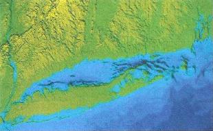
Glacial History of Long Island
Lower Cretaceous
Marine Environment
100 - 142 million years ago
Name derived from Latin: "Age of Chalk" (White Cliffs of Dover). Oceans teem with calcareous protozoa (foraminifera and fusulinids), marine reptiles (ichthyosaurs, pleisiosaurs, and mosasaurs), and reef building mollusks called Rudista.
Upper Cretaceous
Continental Deposition
65 - 100 million years ago
Coastal plain sedimentation supplied from the elevated northwest forms a wedge, like coalescing deltas, that thicken to the southeast. Consists of bog, marsh, and stream deposits containing abundant plant debris (ficus, magnolia, sassafras). Top of Cretaceous removed by later glaciation.
Tertiary
Continental Shelf Deposition
2 - 65 million years ago
Removed from areas exposed to later glaciation. A few Tertiary stream and lake deposits have been reported in New Jersey, Cape Cod, and Martha's Vineyard, MA.
Illinoisan Glaciation
115,000 years ago
Wisconsin Glaciation
60,000 - 25,000 years ago
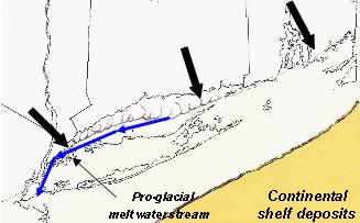
Ronkonkoma-Duke Island Glacier
20,000 years ago (bp-before present)
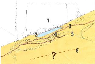
1. Harbor Hill - Fishers Island Glacier 19,000 bp
2. Pro-glacial melt water Lake Peconic is formed 18,500 bp
3. Ronkonkoma-Duke Island Moraine
4. Drift - mostly Outwash
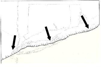
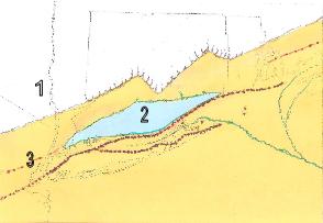
1. Captain-Norwalk Islands Glacier 17,500 bp
2. Pro-glacial "Lake Connecticut" begins 17,500 bp
3. Harbor Hill - Fishers Island Moraine 19,000 bp
4. Fresh water Lake Peconic drains at Block Island.
5. Peconic River is now fed by meteoric water, not by melt water 18,000 bp
6. Farthest extent of Wisconsin Glacier is unknown; approximately 25,000 years ago (bp).
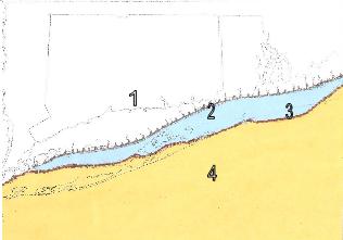
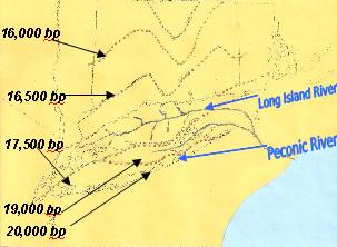
1. Ice retreats to Connecticut 16,000 bp
2. Pro-glacial fresh water Lake Connecticut is at its maximum.
3. Captain Islands-Norwalk Island Moraine is submerged.
Land rises as ice is removed (isostatic rebound).
Glacial retreat accelerates as more land surface is exposed.
Sea level rises faster than the rebound of the lithosphere.
Fresh water Lake Connecticut breaches near Fishers Island and drains south into the Atlantic Ocean.
A "Connecticut River", that is sustained by meteoric water (rain), is formed.
* In the evolution of Long Island Native American Cultures, it is the time of the "Paleo Stage" (Big Game Hunters - 10,500 to 7000 bp. followed by the "Archaic Stage" (Hunters and Gatherers - 4500 to 2000 bp.).
As sea level rises, Long Island Sound and Peconic Bay fill with marine water. 2500 - 5000 bp
* It is the begining of the "Transitional Stage" (Orient Culture - circa 2000 to 1000 bp); followed by the "Woodland Stage" (Hunters, fisherman, farmers - 1000 bp. to European contact).
* The way people adapt to the environment determines their culture. The flora changes with changing climate, new vegetation. With the changing environment. As a result, Native Culture also evolved. Finally, new waterways opened up making fishing and shellfish avaiable. Population and community growth is the trend, barring catastrophic events. Nomatic people,of course, have cultures unique to their environment.
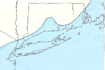
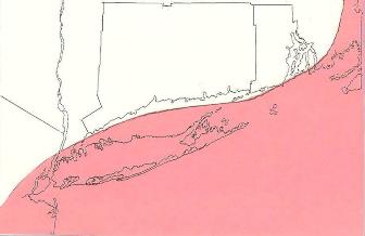
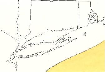
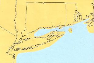
Digital map of present coastlines
After Glaciation
pictures taken in the 1960s and 1970sExamples of land features that were formed as a result of erosion and deposition by ice (glaciers), streams (melted water), ocean currents (longshore and waves), and sometimes even wind, in the case of ancient and recent dunes.
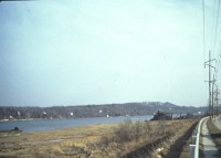
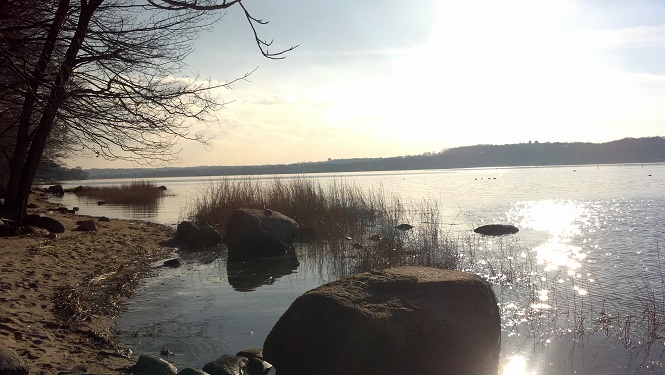
Harbor Hill Moraine seen looking east across Hempstead Harbor, a drowned river valley.
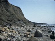
Ronkonkoma Moraine and boulder beach at Montauk Point.
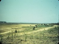
Outwash plain (Hempstead plains) Now occupied by Nassau Coliseum
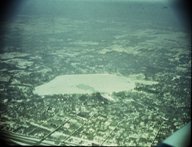
Lake Ronkonkoma, Long Island's largest and best known kettle lake.
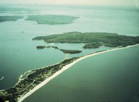
Eaton's Neck near Northport is an example of tombolo, a sandy beach that connects an island to the mainland.
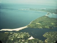
A bay mouth bar at the mouth of the Nissequogue River.
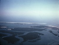
Barrier Beaches, Fire Island overlapping Jones Beach, shelter the Lagoon (the bay) behind them.
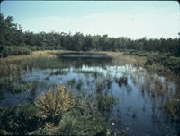
The Frost Creek Marsh near Bayville is filled with plant growth.
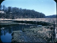
Marshes along the Carmens River where eventually spongy peat forms from organic material.
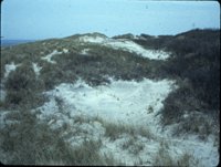
Sand Dunes form on a barrier beach.
Written by: George J. Allgaier, Curator of Geology
References:
Sirkin, Les: 1995, "Eastern Long Island Geology with field trips" Book and Tackle Shop, R.I.
1996, "Western Long Island Geology with field trips" Book and Tackle Shop, R.I.
1996, "Block island Geology" Book and Tackle Shop, R.I.
Stone, Janet R., et.al., 2005 : "Quaternary Geologic Map of Conneccticut and Long Island Sound Basin", USGS Scientific Investigations Map 2784.